Revealing Archipelagos in Unprecedented Detail: How Umbra Scan Transforms Wide-Area Imaging
Archipelagos are some of the most visually stunning and geologically complex regions on Earth. They stretch across vast distances, hide shallow reefs beneath shifting waters, and often span hundreds—sometimes thousands—of islands and cays. But capturing these environments with clarity is difficult. Clouds, weather, light conditions, and sheer geographic scale introduce barriers that traditional imaging tools struggle to overcome.
Umbra Scan changes that.
With wide-area coverage, all-weather fidelity, and meter-level resolution, Scan gives analysts, researchers, and operators a powerful new way to visualize large, intricate landscapes—no matter the conditions.
A New View of the Bahamas
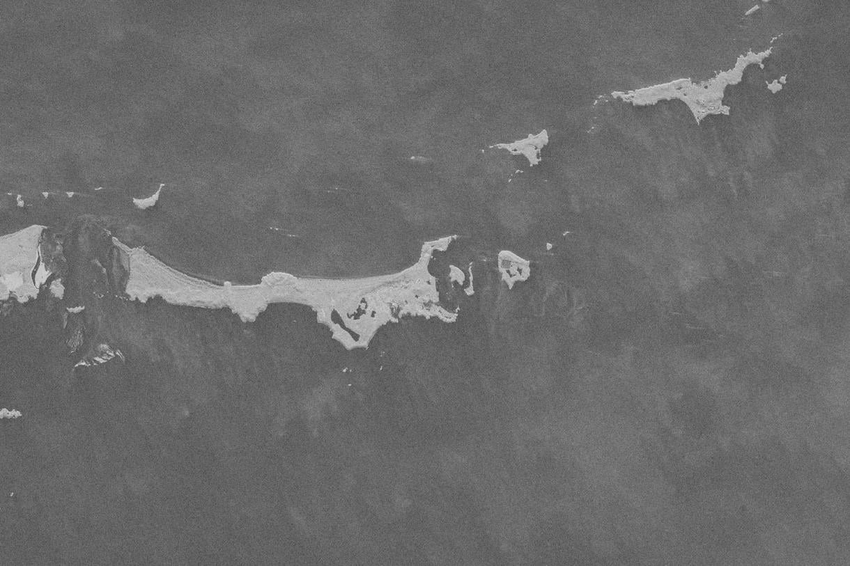
One of the world’s most iconic archipelagos, the Bahamas is home to more than 700 islands and roughly 2,500 cays. Spread across warm Atlantic waters, the region’s vastness makes it a perfect example of where wide-area SAR imaging delivers immediate value.
Using Umbra Scan, we captured a sweeping, detailed view of this complex island chain—bringing the geography, patterns, and contours of the landscape into sharper focus.
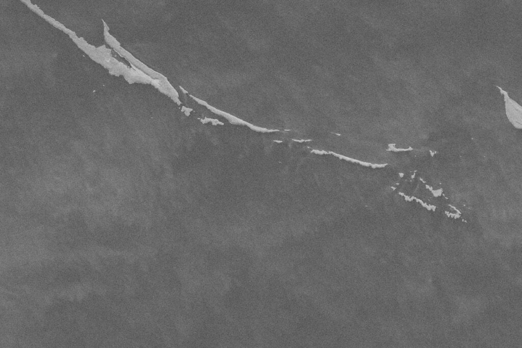
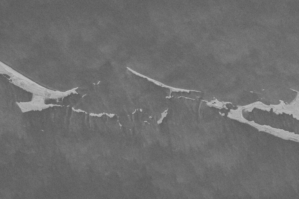
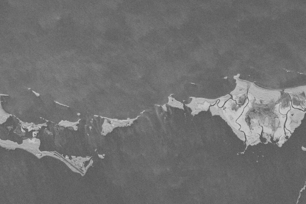

Resolution: 1 m, Mode: 1 look, Collect Date: November 13, 2025, Location: 24.6° N, 76.8° W
Why Wide-Area SAR Matters
Unlike optical sensors, SAR is unconstrained by clouds, weather systems, or daylight. For archipelagos—where storms are frequent, humidity is high, and conditions shift fast—this reliability is essential.
With Scan, users gain:
- Consistent coverage during any season, at any hour
- High-resolution insights that illuminate coastlines, reefs, and landforms
- A scalable view that makes it easier to understand regional patterns
- Flexible tasking that supports missions across environmental monitoring, maritime awareness, resilience planning, and more
Whether you’re tracking coastal change, assessing storm impacts, or mapping remote terrain, wide-area SAR imaging provides a comprehensive foundation for understanding what’s happening across dispersed environments.
Expanding What’s Possible to See
By pairing wide-area coverage with reliable, all-weather imaging, Umbra Scan allows stakeholders to observe landscapes that once seemed too vast or too complex to capture clearly. The Bahamas imagery is just one example of how SAR can illuminate entire regions with consistency and depth.
See how Umbra Scan redefines what’s possible in wide-area visualization—and discover how it can support your mission.
Revealing Archipelagos in Unprecedented Detail: How Umbra Scan Transforms Wide-Area Imaging
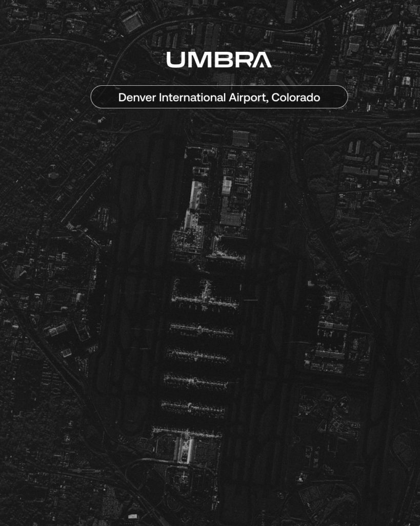
Archipelagos are some of the most visually stunning and geologically complex regions on Earth. They stretch across vast distances, hide shallow reefs beneath shifting waters, and often span hundreds—sometimes thousands—of islands and cays. But capturingSeeing the Holiday Rush from Above: How Umbra’s Constellation Reveals the True Pace of America’s Busiest Airports
Every year, millions of travelers take to the skies to reunite with family, explore new places, or make the most of a well-earned break. And every year, the nation’s busiest airports feel the pressure. Terminals